
Utility Location Services
Know What’s Below Before You Dig
Subsurface Geoservices and Solutions (SSGS) provides professional utility location services across Nelson, Tasman, Marlborough, and the wider Top of the South Region.
Using advanced detection technology and proven field expertise, we help engineers, contractors, councils, and property owners identify underground services accurately and safely — before excavation begins.
Why Choose SSGS for Utility Location?
We locate both known and unknown underground infrastructure, delivering clear, practical information you can rely on.
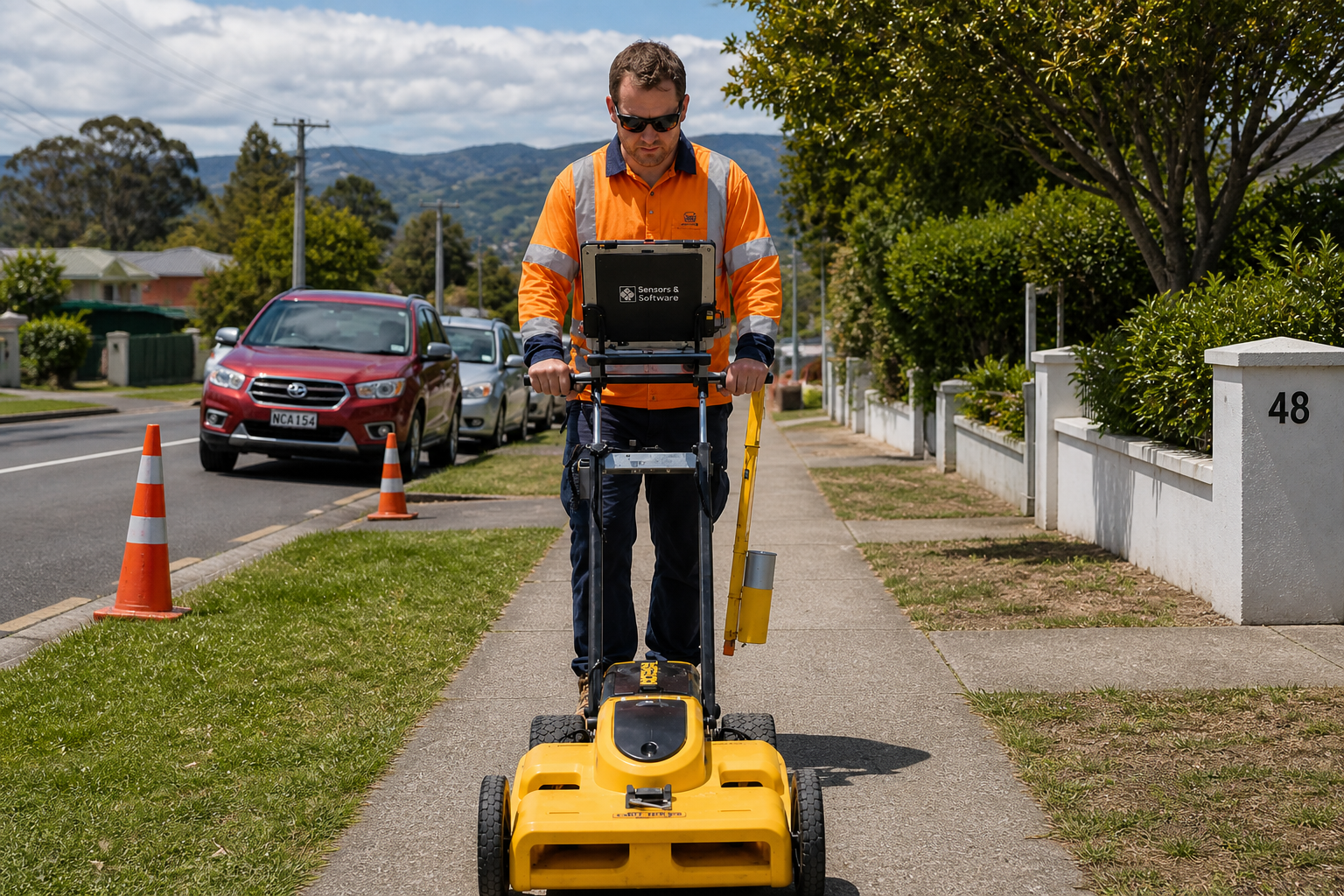
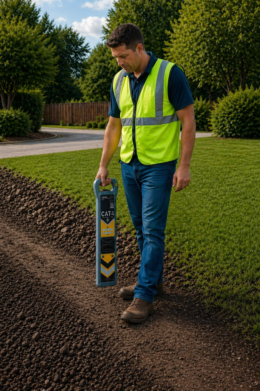
Advanced detection technology including EMI scanning and Ground Penetrating Radar (GPR)
Accurate, field-verified results, not just records-based assumptions
Local knowledge of Nelson and surrounding ground conditions
Clear deliverables suitable for engineers, contractors, and consent documentation
Responsive, professional service aligned with project timeframes
Whether you’re planning construction, subdivision works, trenching, or maintenance, our utility location services reduce the risk of service strikes, costly delays, and safety incidents.
Our Utility Location Services
-
EMI scanning is a fast and effective method for detecting metallic underground services. We use electromagnetic induction to trace live and passive services, helping identify:
Electrical cables,
Telecommunications infrastructure,
Metallic pipes and other infrastructure.
EMI scanning is best suited for active services, urban environments, and pre-excavation investigations.
-
Ground Penetrating Radar (GPR) allows us to locate both metallic and non-metallic services that may not appear on records. GPR is ideal for identifying:
Plastic pipes and ducts,
Concrete services and structures,
Voids, anomalies, and changes in ground conditions.
Ground Penetrating Radar is best suited for complex sites, unknown services, concrete scanning, and high-risk excavation areas.
-
Our pipe and duct tracing services accurately map the alignment and depth of underground pipelines and conduits using a combination of EMI equipment, sondes, and tracing techniques.
This service is commonly used for:
Water, wastewater, and stormwater networks,
Electrical and telecommunications ducts,
Asset verification and mapping.
Our pipe and duct tracing services provide a clear understanding of service routes to support design, maintenance, or excavation.
-
Sonde tracing is used to locate non-metallic pipes, ducts, and drains that cannot be detected using standard electromagnetic locating methods. A small transmitter is inserted into the pipe or conduit and tracked from the surface, allowing the route and depth of the service to be identified with greater confidence.
Sonde tracing is commonly used for:
Locating plastic drainage pipes and stormwater lines,
Tracing underground ducts and conduits,
Verifying pipe routes where records are unclear,
Confirming pipe connections and direction,
Supporting utility location before excavation or construction.
-
SSGS offers CCTV inspection of drains and pipelines to assess internal condition, alignment, defects, and blockages. Our inspections support:
Condition assessments,
Pre-purchase property investigations,
Fault identification and maintenance planning,
Confirmation of pipe connections and construction quality.
Inspections are carried out using a push-rod CCTV inspection camera with an integrated metre counter and sonde transmitter, enabling accurate recording of defect locations and allowing pipelines to be traced from the surface where required.
All inspections and defect logging are undertaken in accordance with the New Zealand Pipe Inspection Manual – Third Edition (NZPIM / PIM3) to ensure compatibility with council asset management systems.
Video footage and observations can be incorporated into project documentation where required.
-
Our manhole survey services provide accurate information on invert levels, pipe connections, manhole condition and configuration. Manhole surveys are often required to support:
Engineering design,
Network upgrades,
Asset verification,
Drainage investigations.
We deliver reliable field data that can feed into design and reporting workflows.
Frequently Asked Questions
-
Underground services are often poorly documented or inaccurately mapped. Locating services before excavation helps prevent service strikes, safety incidents, costly repairs, and project delays. It also supports compliance with health and safety obligations.
-
Using a combination of EMI scanning, Ground Penetrating Radar (GPR), and tracing methods, we can locate:
Electrical and telecommunications cables
Water, wastewater, and stormwater pipes
Gas services
Ducts and conduits
Other subsurface structures and anomalies
-
EMI scanning is used to detect metallic services by inducing and tracing electromagnetic signals.
GPR uses radar waves to detect both metallic and non-metallic services, as well as changes in ground conditions.
On many sites, the two methods are used together to improve confidence and coverage.
-
Yes. Many underground services are either missing from records or inaccurately mapped. Our locating methods are designed to identify unknown or unrecorded services where possible, reducing uncertainty before excavation.
-
Utility locating is a risk-reduction process rather than a guarantee. While we use industry-standard equipment and experienced operators, factors such as ground conditions, service materials, and site complexity can affect results. We clearly communicate confidence levels and limitations as part of our service.
Get Confidence Before You Dig
If your project involves excavation or underground works, engaging SSGS early helps reduce risk and uncertainty. Contact SSGS today to discuss your utility location requirements and arrange a site investigation.